Features

Geology
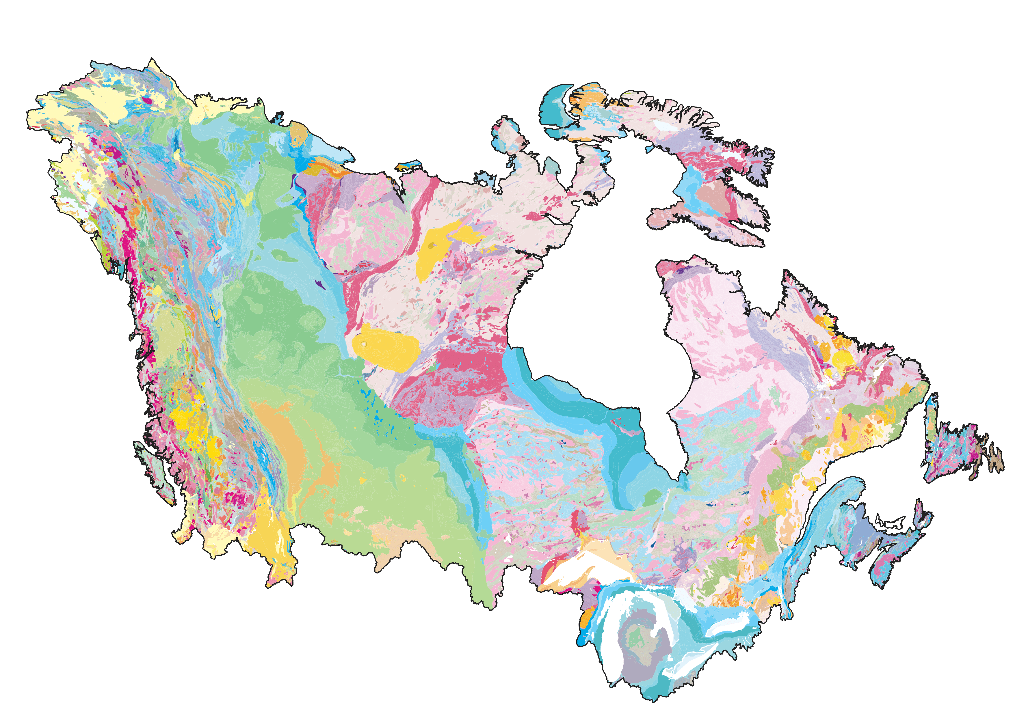
Geological datasets for building models

Climate
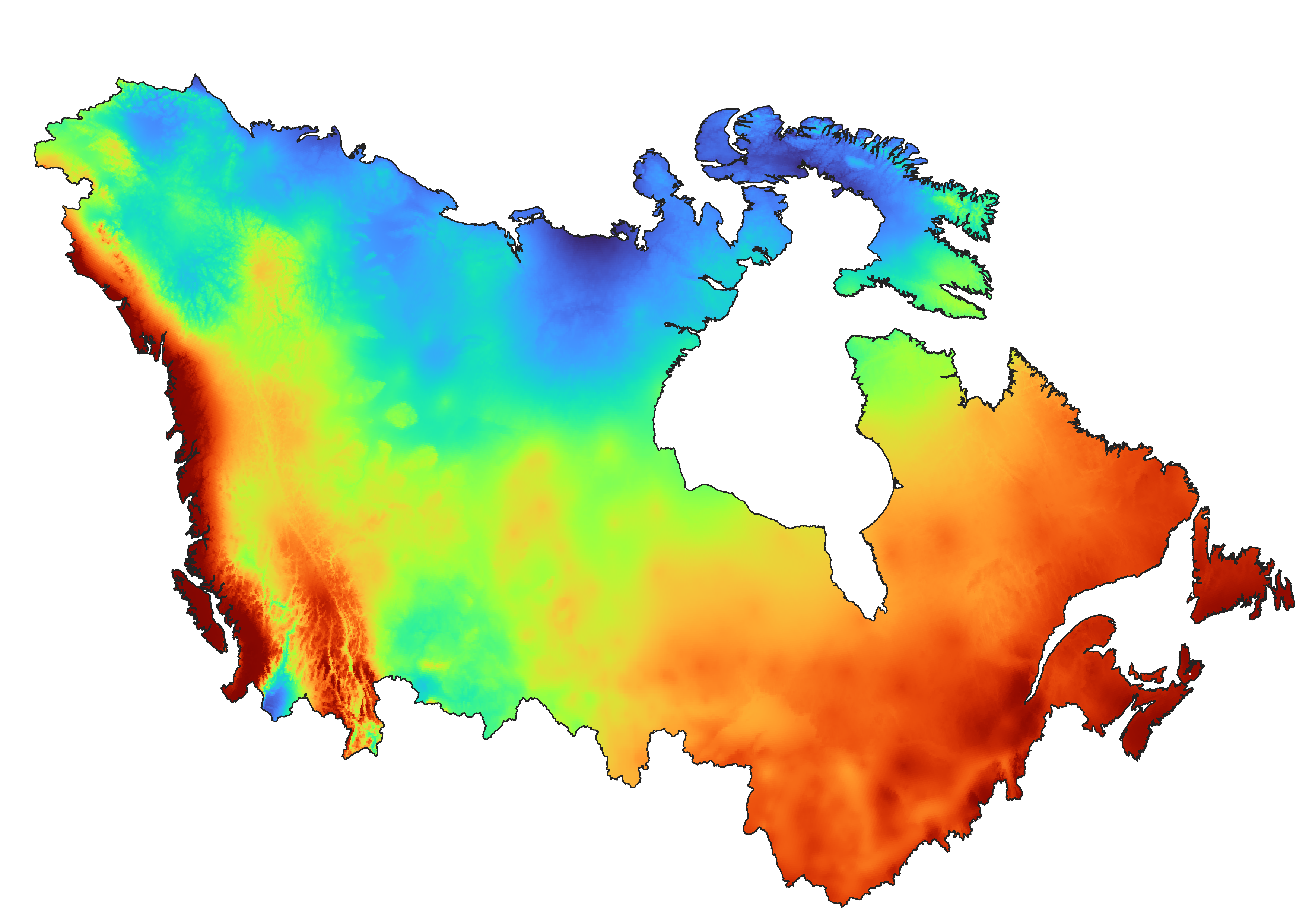
Historical and Future Climate forcing

Models
3D HydroGeoSphere models

Projections
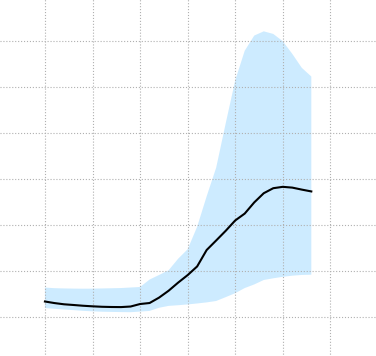
Mid- and End-Century Hydrological Projections

Geological datasets for building models

Historical and Future Climate forcing

3D HydroGeoSphere models

Mid- and End-Century Hydrological Projections
A continental scale framework will be available to support a decision support system (DSS) that can support community-based information dissemination and interrogation. The modelling of groundwater-surface-water will be based on the HydroGeoSphere platform. The online DSS platform will provide a window to the model results and provide information accessible to the nontechnical user at public, community, watershed management level, and higher governmental levels.
Illustrative outputs through the DSS are climate change impacts to Canadian water resources (surface water and groundwater), including how flood and drought frequency may potentially change, for mid- and end-century time intervals.
A fully integrated surface/groundwater model for all of continental Canada (Canada Continental Scale Model - CCSM) was initiated in 2009 using HydroGeoSphere (HGS). The first version of the CCSM was completed in 2020 (read more here). It demonstrated large-scale ground/surface water interactions and water balances, including regions in Canada's far north; where hydrologic monitoring data is extremely sparse, and yet where climate change impacts are anticipated to be most severe.

PLEASE READ THESE TERMS AND CONDITIONS OF USE CAREFULLY BEFORE USING THIS WEBSITE.
Your use of portal.canada1water.ca (the "Website") is expressly conditioned on your acceptance without modification of the following terms and conditions (the "Terms and Conditions").If you accept these Terms and Conditions, click on the "I Accept" button below. That action is the equivalent of your signature and indicates your acceptance of these Terms and Conditions and that you intend to be legally bound by them. If you do not agree with them, please click on the "Back" button of your browser or click on the "Cancel" button below to exit this Website.
Note that all of the Terms and Conditions below are subject to the laws of the place where you live, and some of them might not be binding on you under those laws.
Aquanty Inc. ("Aquanty") may, in its sole discretion and for any reason, modify, supplement or amend these Terms and Conditions without any notice or liability to you or any other person, by posting revised Terms and Conditions on the Website. Your continued use of the Website signifies your acceptance of any revised Terms and Conditions, so check back frequently to read the most recent version.
The Website URL, its design, all text, graphics, content, video, audio and the selection and arrangement of the Website are the property of Aquanty, and/or its various subsidiaries, affiliates, third party providers and distributors ("Third Parties"), and are protected under the copyright laws of Canada and other countries. None of the content found on the Website may be reproduced, republished, distributed, displayed, sold, transferred, or modified without the express written permission of Aquanty or the applicable Third Parties.
The Website, and all other related trademarks and design marks displayed on the Website (collectively, the "Trademarks") are registered and common law trademarks of Aquanty. Other trademarks and design marks appearing on the Website are trademarks of their respective owners. Nothing contained on the Website should be construed as granting, by implication or otherwise, any license or right to use any trademarks, including the Trademarks, except with the express written permission of Aquanty or the other party that may own the applicable trademarks.
All content included on this website, such as text, graphics, logos, button icons, images, audio clips, digital downloads, data compilations, and software, is the property of Aquanty or its content suppliers and protected by Canadian and international copyright laws. The compilation of all content on this Website is the exclusive property of Aquanty and protected by Canadian and international copyright laws. All software used on this Website is the property of Aquanty or its software suppliers and protected by Canadian and international copyright laws.
You may use this website only if you are a resident of Canada or the United States have reached the age of majority where you live, and can form legally binding contracts under applicable law. You may not use this Website if you live in a jurisdiction where access to or use of the Website or any part of it may be illegal or prohibited. It is solely your responsibility to determine whether your use of this Website is lawful, and you must comply with all applicable laws.
Neither the Website nor its contents may be, in whole or in part, copied, reproduced, republished, uploaded, posted, transmitted or distributed without the written permission of Aquanty, except that you may download, display and print the content presented on the Website for your personal, non-commercial use only. Unauthorized use of the Website and/or the content contained on the Website may violate applicable copyright, trademark or other intellectual property laws or other laws. You must retain all copyright and trademark notices, including any other proprietary notices, contained within the content on this website. The use of that content on any other website or in any environment of networked computers is prohibited. You are not permitted to engage: (i) in any resale or commercial use of the Website or its contents; (ii) any collection and use of any product listings, descriptions, or prices; (iii) any derivative use of the Website or its contents; (iv) any downloading or copying of account information from the Website for the benefit of another merchant; or (v) any use of data mining, robots, or similar data gathering and extraction tools on the Website.
In its sole discretion, in addition to any other rights or remedies available to Aquanty and without any liability whatsoever, Aquanty may at any time and without notice terminate or restrict your access to any component of the Website.
Your Website account may be accessed only by use of your login name and password. You are solely responsible and liable for any use and misuse of your login name and password and for all activities that occur under your login name and password. For security reasons, you must keep your login name and password confidential and not disclose them to any person or permit any other person to use them, except an authorized representative of Aquanty. Aquanty recommends that you choose a password that is unique to you and not easily guessed by others. You should change your password on a regular basis, and you must log out at the end of each session.
All login names and passwords remain the property of Aquanty, and may be cancelled or suspended at any time by Aquanty without any notice or liability to you or any other person. Aquanty is not under any obligation to verify the actual identity or authority of the user of any login name or password.
You must immediately notify Aquanty of any unauthorized use of your login name or password, or if you know or suspect that your login name or password has been lost or stolen, has become known to any other person, or has been otherwise compromised.
You have read Aquanty's Privacy Policy, the terms of which are incorporated into these Terms and Conditions, and you agree that the terms of that policy are reasonable. You consent to the collection, use and disclosure of your personal information by Aquanty in accordance with the terms of and for the purposes set out in Aquanty's Privacy Policy.
Except as explicitly provided in these Terms and Conditions, as amended from time to time, Aquanty and the Third Parties make no representations or warranties of any kind, express or implied, regarding the Website and/or any content, products or services provided on the Website, all of which are provided on an "as is" and "as available" basis. Aquanty expressly disclaims all warranties and conditions with respect to this Website, its content or data, and any products or services offered on the Website, including without limitation all implied warranties or implied conditions of merchantability, fitness for a particular purpose, title and non-infringement, and those arising by statute or otherwise in law or from a course of dealing or usage of trade.
Aquanty and the Third Parties do not warrant or guarantee: (i) the accuracy, completeness, correctness, currency, reliability, timeliness, usefulness or suitability of the Website or any of the information, content or data downloaded, found or otherwise obtained from the use of the Website; (ii) the results that may be obtained from the use of this Website or the information, content or data obtained from this Website; (iii) that the use of this Website or any information, content or data on this Website will meet any user requirements; (iv) that access to the Website will be uninterrupted, timely, secure or error-free; or (v) that the information, content, data and other materials available from the Website will be free of infections, viruses, worms, Trojan horses or other code that could be harmful to your computer system.
You acknowledge and agree (i) that your use of this Website and any material, information or data downloaded or otherwise obtained through the use of this Website is at your sole discretion and risk, and (ii) that you are solely responsible for any damage you may sustain, whether relating to (a) your computer system, or any loss of data that results from the download of any material, information or data, or (b) your reliance on any information or data obtained as a result of your use of this Website, or (c) any other form of damage that may be incurred. In no event will Aquanty or the Third Parties be liable for the conduct of users of this Website.
If Aquanty or any of the Third Parties should be found liable for any loss or damage which arises out of or is in any way connected with any of the functions or uses of the Website or its content, or any of the products or services offered on the Website, the liability of Aquanty and the Third Parties will in no event exceed in the aggregate the amount paid by you under these Terms and Conditions for the specific product or service to which the loss or damage relates.
In no event will Aquanty or any of the Third Parties be liable for any direct, indirect, punitive, special, incidental, exemplary or consequential damages, damages for loss of use, data, information, or profits or business interruption, or any other damages whatsoever arising out of or in any way related to the use or performance of this Website, any linked website, or any information, content or data, obtained through this Website, or otherwise arising out of your use or inability to use this Website or any decision made or action taken by you in reliance on any information or materials provided on this Website, and/or any errors or omissions in such content, whether such damages are based in tort, contract, negligence, strict liability or otherwise, even if Aquanty has been advised of the possibility of such damages.
You will indemnify, defend and hold harmless Aquanty and the Third Parties and their respective officers, directors, employees, consultants, representatives and agents from and against any losses, claims, damages, causes of action or demands, including without limitation reasonable legal, accounting and other professional fees, arising from or related to: (i) your use of and reliance on the Website; (ii) your use of and reliance on any material, information, data, or other content downloaded or otherwise obtained from the Website; or (iii) your violation of these Terms and Conditions.
Aquanty relies on the information you provide through this Website, including registration information (name and email address), payment information (credit card numbers and expiration dates), and transaction-related information, which must be true, accurate, current and complete. You will be solely responsible and liable for any and all loss, damage, and additional costs that you, Aquanty or any other person may incur as a result of your submission of any false, incorrect or incomplete information or your failure to update your registration information and payment information within 30 days of any change.
The Website contains links to websites owned or operated by other entities which are not associated or affiliated with Aquanty or the Third Parties. These links are provided solely as a convenience to you and the inclusion of any link does not imply endorsement, investigation or verification by Aquanty or the Third Parties of the linked website or information contained in the linked website, or of their security or privacy practices. Aquanty and the Third Parties will not be responsible for the content of any other linked websites and makes no representation or warranty regarding any other websites or the contents on those websites. If you decide to access other websites, you do so at your own risk.
Linking to any other website is at your sole risk and Aquanty will not be responsible or liable for any damages in connection with such linking. In addition, Aquanty does not endorse or approve of any websites linked from or to the Website, except for other websites operated by Aquanty.
You may not gather, extract, reproduce and/or display on any other non-Aquanty website or other online service, any material on or from the Website, whether or not by the use of spiders or other ‘screen scraping' software or system used to extract data without the express consent of Aquanty.
If you download any software, Aquanty is not responsible or liable for any difficulties or consequences associated with downloading that software. The use of any downloaded software is governed by the terms of the applicable license agreement, if any, which accompanies that software or is provided with that software or is in these Terms and Conditions.
The provisions above that follow the heading "Liability Disclaimer" will survive the termination of your access to the Website.
The relationship between Aquanty and you will be that of independent contractors, and neither party nor any of their respective officers, agents or employees will be held or construed to be partners, joint ventures, fiduciaries, employees or agents of the other as a result of these Terms and Conditions or your use of the Website.
These Terms of Use are governed by the laws of the Province of Ontario and the laws of Canada applicable therein without regard to any conflict of laws provisions. You expressly consent that the exclusive jurisdiction of the courts located in Waterloo, Ontario with respect to any dispute arising under these Terms and Conditions, unless otherwise agreed by Aquanty in its sole discretion.
The headings used in these Terms and Conditions are included for convenience only and will not limit or otherwise affect these Terms and Conditions.
These Terms and Conditions will be severable. In the event that any provision is determined to be unenforceable or invalid, that provision will nonetheless be enforced to the fullest extent permitted by applicable law, and that determination will not affect the validity and enforceability of any other remaining provisions of these Terms and Conditions.
Any waiver of any provision of these Terms and Conditions will be effective only if in writing and signed by Aquanty and only applicable to the specific incident and occurrence so waived. The failure by Aquanty to insist upon the strict performance of these Terms and Conditions, or to exercise any term hereof, shall not act as a waiver of any right, promise or term, which shall continue in full force and effect. These Terms and Conditions will inure to the benefit of Aquanty's successors and assigns.
These Terms and Conditions, together with any rules, policies or guidelines posted on the Website by Aquanty or incorporated or referred to herein, constitute the entire agreement between you and Aquanty with respect to the subject matter hereof, and supersedes any prior agreements, understandings, negotiations and discussions, whether electronic, oral or written, regarding the subject matter of these Terms and Conditions, and may not be amended or modified except by Aquanty. No party has been induced to enter into these Term and Conditions in reliance on, and there will be no liability assessed, either in tort or contract, with respect to, any warranty, representation, opinion, advice or assertion of fact, except to the extent it has been reduced to writing and included in these Terms and Conditions or a document incorporated or referred to in these Terms and Conditions.
When you visit the Website or send e-mails to Aquanty, you are communicating with Aquanty electronically. You consent to receive communications from Aquanty electronically. Aquanty will communicate with you by e-mail or by posting notices on this Website. You agree that all agreements, notices, disclosures and other communications that Aquanty provides to you electronically satisfy any legal requirement that such communications be in writing.
The legal business name of Aquanty is Aquanty Inc. Please direct enquiries to Aquanty's registered business address at: 600 Weber Street North, Unit B, Waterloo, ON, Canada N2V 1K4; or by telephone at 1-519-279-1080.
The parties have requested that these Terms and Conditions and all documents contemplated by these Terms and Conditions be drawn up in English. Les parties aux présentes ont exigé que cette entente et tous autres documents envisagés par les présentes soient rédigés en anglais.
600 Weber Street North, Unit B
Waterloo, ON, N2V 1K4
(519) 279-1080
Monday – Friday: 9AM – 5PM
Send inquiries to canada1water@aquanty.com